443
Spaces of Resistance and (In)security
Introduction
The topic of the ‘architecture of occupation’ in Palestine has been recently explored by several scholars. Architectural and spatial theory has been shown to influence Israeli military operational tactics and strategies; furthermore, infrastructure and settlement patterns among other components have been theorized as tools utilized by the state of Israel for the colonization and control of Palestinian land and resources (Weizman 2012).
My master’s thesis research seeks to complement existing studies on the architecture of occupation in Palestine by foregrounding the "architecture of resistance", shifting the focus to the agency of Palestinians, and thus questioning the implied hegemonic omnipotence of colonial control.
In particular, my thesis investigates how colonial subjects utilize space to challenge settler-colonial power. The project is motivated by my aim to understand the mechanisms of spatial practice in zones of conflict, particularly the ones utilized by weaker parties. It studies the spatiality of Palestinian resistance relating to settler road infrastructure during the First Intifada in the Western Ramallah villages around the area of—what later came to be—Road 443.
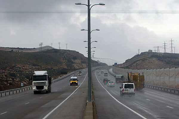
This road, shown above, is a massive piece of infrastructure "Israel" constructed in the occupied West Bank in the 1980s. It connects Tel-Aviv to Jerusalem, and has been designated solely for Israeli citizens’ use since the early 2000s, and is currently the most heavily monitored road under Israeli control, employing security architecture tools such as the tower and fences visible in the picture below—it has also been a site of Palestinian contestation and resistance (Jabary Salamanca 2015). By mapping, visualizing, and analyzing acts of Palestinian resistance that relate to this road, my research seeks to offer a nuanced understanding of the relationship between Palestinian resistance and settlement infrastructure planning.
The concept of security lies at the core of my project, one whose varying definitions serve as lenses for investigating the utilization of space and built form by both colonizer and colonized. My use of the concept of security encompasses themes such as surveillance, control, urban warfare, and ‘sumūd’ (i.e. steadfastness: food security, economic security, etc.). The inclusion of such concepts as food and economic security allows the study to incorporate significant spatial practices such as home farming (on the part of the colonized), or farmland confiscation (on the part of the colonizer).
For a background on Road 443, use the left panel to navigate to the "History" page. For the analysis of resistance and security in the geography of Road 443, navigate to the "Geography" page.